Saturday 3 October 2015

Paddling The Wilderness Coast, Greenglades to Bemm River

Due to an ongoing injury I had to shelve my original more committing paddle trip until next year. I had organised my ground crew for the planned trip though and Mark was still keen to see some Wilderness, so that's what we did! Mark would spend the first night at Merrica River before I would head further south alone and meet up the next day in Victoria.


The southern end of Croajingolong NP near Bemm River would be our finish spot three days later. We left Greenglades late in the afternoon for the short paddle to Merrica River so I could get away early the next morning.

Greenglades
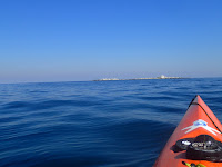
Heading for Merrica River


Merrica River
Beef Vindaloo!

Merrica River to Mallacoota 

I departed Merrica River for Mallacoota at 8am trying to get there in time for the cricket world cup final  I missed the first few overs due to the light to moderate head winds which picked picked up around Cape Howe. I had a quick stretch and something to eat at Gabo Island before arriving at Mallacoota 6:45 later. Distance 49km. Mark paddled back to Greenglades and picked up the car to RV in Mallacoota.
Paddling the Nadgee Coast
Iron oxide in the sea cliffs

Approaching Cape Howe

Gabo Island

Arriving at Mallacoota
Mallacoota to Wingan

I had been told that Wingan Inlet was a nice place to stay with lot's of mussels on offer, so Wingan Inlet was going to be the next shorter leg. I saw two large Bronze Whalers on this leg, one of them launched a metre in the air doing acrobatics. Lot's of seal's around the Skerries, which is a small island near the entrance to Wingan Inlet. Mark met me at the river mouth and we collected some mussels for dinner. I had light winds and a small 1 metre easterly swell. Travel time of 4:20 and distance of 34km for this shorter day.

Dunes south of Mallacoota
Isolated cliff lines


The Skerries

Looking back at the Skerries

Collecting dinner

Friendly local

Asian Mussels coming up
Wingan Entrance 
Wingan to Bemm River

After a noisy night from the seals located at the Skerries we woke up in the darkfor the final day's paddle There was a lot of smoke from  the HR burns as I headed out past the Skerries. I headed for Pt Hicks for a lunch break and then onto Bemm River. We were told that Sydenham Inlet was open to the ocean but this would turn out to be incorrect as we were later told it had closed a couple of weeks earlier. I had a 50m or so portage before paddling into the small township of Bemm River. The winds came up from the ENE at around 20 kt mark which gave me some nice runners for the final leg along the coast. This was a great short trip along the NSW and Victorian Coastal Wilderness. Thanks Mark for coming along for the adventure.Travel time 7 hrs, distance 57km. Total distance for the 3 days 143km.
Skerries by name Skerries nature!
Just north of Pt Hicks

Lunch just north of Pt Hicks

Sydenham Inlet, closed!

Portage coming up
Sydenham Inlet


Thursday 1 October 2015

Montague Island By Sea Kayak

Although this is the fifth time I have kayaked from Narooma to Montague Island and then on to Bermagui it was definitely the most memorable!

Wow what a trip. The NE wind came up early which made me smile as I approached Montague Island, knowing I had a 20km+ downwind paddle to Bermagui ahead. I had a quick break at the Island (in the kayak) before starting my downward leg of the trip. I was about halfway to Bermagui when I heard what I thought was a rogue wave breaking behind me. I turned my head and received a massive fright! Approximately 10-15m behind me was a massive hump back whale half way out of the water in the middle of a full breach. The landing was like an explosion with the shock wave hitting my stern. I was honestly worried he would land on my back deck! I broke left to get out of his path but he must have smelt my pants and gave me some space before performing more breaches to now enjoy. The photo's don't give this experience justice! In 17 years of kayaking I have never experienced such emotion as having the giant of the sea in such close proximity. Trip 34.4km, max speed 19.26km/hr, moving average 9.07km/hr, Kayak Rockpool Taran. www.oceanwilderness.com.au


Tuesday 2 April 2013

Day 8 Spike cove to Little Musselroe Bay

SE15-20 kts 1-1.5m sea's. The wind was howling during the night but the forecast was for it to ease the next day. There was a change approaching  the following day so I was keen on getting the last leg of the trip completed. I could only see the higher ground of mainland Tasmania with the coast being hidden until the final 3 nautical miles from Little Musselroe Bay. It was another rough paddle with wind against current for the second half of the crossing.It was a fitting end to this adventure.Thanks to my family and friends Mark Clarke, Steve Holley and Rob Howe from Howe Shipwrights in Sydney for helping me with the kayak modifications. Also thanks to Karel Vissel  for the weather forecasts. I also used BOM and Willy weather for my weather forecasts and tidal information. Average speed 3.9 kts www.oceanwilderness.com.au

Monday 1 April 2013

Day 7 thunder and Lightening Bay to Clarke Island

SE15- 20 kts sea's 1-1.5m. I had a bit of a sleep in and waited until just before high tide to depart. It was a very still morning as I headed out on the western side of Preservation Island to get a nice straight run to Clarke with the help of the current and was making great time for the first 45 minutes until the SE wind kicked in and built in strength. I had the current with me but as the head wind approached the 25- 30 kt mark it became very hard going with constant waves breaking in my face. It was the shortest paddle of the trip but also the hardest. I battled my way into Spike Cove with a rough tidal race around the head land. A couple of fishing boats were seeking shelter there as well. They offered me a beer as soon as I told them my launch location of Victoria. Average speed 3.7 kts


Day 6 Whitemark to Thunder and Lightening Bay

NE 15 kts seas 1m. I  set off at 0700 to take advantage of the tide. I looked at my ipad during the night and the wind was blowing NE to 26 kts but had eased a little in the morning. The forecast of 15 kts was already been exceeded one hour into my paddle. The wind was gusting in the vicinity of 30 kts with a steady 20-25 kts. I stayed as close to shore as possible to get some protection until I could use it to my advantage and shoot across to Trouser Pt with it behind me. I had a max speed reading of 10 kts over this short crossing of the bay. I landed at Trouser Pt where there is a great camp ground with water and toilets. I observed modified wind gusts of over 30 kts. I waited for an hour or so to see if the winds would abate. I changed paddles to my flat blade with the anticipation of a rough crossing of Franklin Sound to Cape Barren Island. It was going to be wind against current but as the wind had eased a  little I decided to make the crossing. I had quartering sea's for the crossing and the skeg I fitted to the Taran was showing it's worth. I went on the inside of Long Island and around Cape Sir John  where I was sheltered from the NE winds. Due to me stopping at Trouser Pt I had lost my window with the current to get a run down to Clarke Island.  I confirmed this when I stopped and was going backwards at 1.5 kts. I wasn't that worried as the forecast for the next day was not looking good for a Banks Strait crossing. I explored Thunder and Lightening Bay and set up camp on an elevated flat rock, it was my best nights sleep of the trip. Average speed 3.8 kts

Day 5 Explored Whitemark

I had a relaxing day swimming, eating , sorting gear and eating! Very friendly  people in Whitemark, I look forward to returning some day.

Day 4 Deal Island to Whitemark

NW 10 -15kts seas nil. I made my way out of  Winter Cove just on first light. As I cleared Deal Island it was a magic day. Unfortunately the NW wind forecast which would have helped me was non existent. I saw a large shark a couple of hours into my trip but it showed no interest in me. I was making good time as I approached Flinders and decided to take advantage of the changing flooding tide and head for Roydon Island. I arrived at Roydon and went for a quick swim and look at the hut which is know fitted with a water tank. I really wanted to stay the night at Roydon but I still had a few hours of flooding tide and daylight left. If I stayed the night I would have been looking at another early start or wait for the afternoon tide. I decided to push on to Whitemark ,  rocketing down the coast with the current assisting me until the last hour when it changed and I had to grit my teeth after a long day. I arrived at Whitemark in the dark and just pulled my bivi bag out and crashed . I woke up and headed for the Bakery for a big breakfast. The forecast for the next day was not great with head winds and currents not in my favour. I decided to have a day off and eat  a  large amount of food and sort  through my gear.Average speed 4.2 kts